Mount Kenya
Mount Kenya
An extinct stratovolcano rising to 5,199 m, Mount Kenya offers three summits, glacial lakes and a UNESCO-listed national park, accessible from Nanyuki.
Mount Kenya is an extinct stratovolcano located 16.5 km south of the equator and approximately 150 km from Nairobi. At 5,199 m, it stands as Africa's second-highest massif after Kilimanjaro. Its snow-capped peaks, residual glaciers and afro-alpine vegetation make it a rare site in an equatorial zone, designated as a UNESCO World Heritage site and inscribed as a biosphere reserve since 1978.
Why visit Mount Kenya
Three compelling reasons draw visitors to this massif. First, its dramatic vertical landscape diversity: tropical forest at the base, bamboo moorland, afro-alpine grasslands with giant groundsels and lobelias, then rocky cliffs and glaciers at the summit. Second, its accessibility to intermediate trekkers thanks to Point Lenana (4,985 m), reachable without mountaineering skills. Finally, its cultural significance: the massif is sacred to the Kikuyu, Embu, Meru and Maasai peoples, whose territories border its slopes.
The national park, established in 1949, is home to elephants, buffalo, antelope, primates and a rich birdlife. Large predators such as lions are present in the forest margins but rarely observed at altitude.
History and mythology of the massif
A sacred mountain for the Kikuyu
According to Kikuyu tradition, the deity Ngai, also known as Mwene Nyaga, resides on Mount Kenya. The founding narrative tells that Ngai created Gĩkũyũ, the first man and ancestor of the Kikuyu people, upon this mountain. The name Mwene Nyaga literally means "ostrich owner", hence the traditional designation of "Mountain of the Ostriches", a reference to the dark and light patches of the summits, likened to the bird's plumage.
The slopes of the massif are home to an ethnic mosaic: Kikuyu to the south and west, Embu and Meru to the east, Maasai in the plains to the south. All maintain a ritual relationship with the mountain.
The first ascent of Batian
The main summit, Batian, was first climbed on September 13, 1899 by British geographer Sir Halford John Mackinder, accompanied by Italian guides Cesar Ollier and Josef Brocherel. It was their fourth attempt, following several failures due to logistics and altitude challenges.
What to see and do on Mount Kenya
The three main summits
- Batian (5,199 m): the massif's highest point, accessible only to climbers skilled in high-altitude rock climbing.
- Nelion (5,188 m): the second peak, equally technical, separated from Batian by the Gate of the Mists notch.
- Point Lenana (4,985 m): the trekker's objective, reachable by the standard trails. The final stretch, secured by cables, is sometimes described as one of the world's highest via ferrata routes, though this classification remains debated.
High-altitude lakes and glaciers
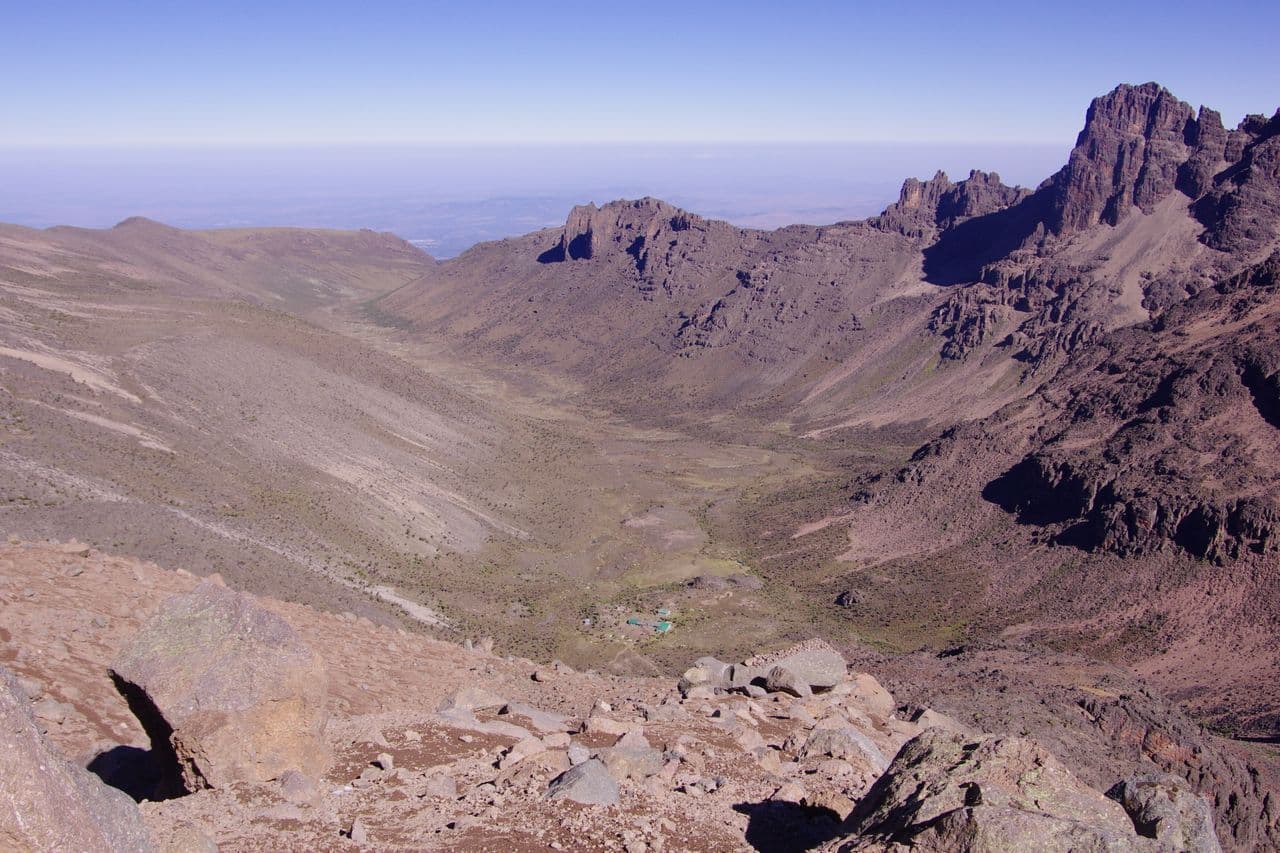
The Chogoria route, on the eastern slope, traverses remarkable glacial landscapes. Ellis Lake (3,450 m) and Michaelson Lake (approximately 3,950 m), nestled in rocky cirques, rank among the park's most photographed spots. Around a dozen glaciers persist near the summits, though their retreat has been documented for several decades.
Park wildlife
On the lower slopes and in the forest, forest elephants, buffalo, duikers, colobus and cercopithecus monkeys are observed. The heathland-grassland zone hosts rock hyraxes and several endemic high-altitude bird species.
When to visit Mount Kenya
The massif's equatorial climate features two dry seasons favourable for climbing:
- January to mid-March: the warmest period, generally clear skies in the morning, optimal conditions for Point Lenana.
- July to October: the second dry window, cooler temperatures, steady visitor numbers.
April-May and November correspond to the two rainy seasons and are best avoided for trekking. Regardless of season, expect sub-zero temperatures above 4,000 m.
Practical information
National park entry is charged (resident/non-resident rates apply, payable on-site or via the KWS platform). An accredited guide is mandatory for the climb, and a porter is strongly recommended. Budget 3 to 7 days on average, depending on your chosen route and acclimatisation pace.
Three main routes lead to the summit:
- Sirimon (from Nanyuki): gradual gradient, ideal for acclimatisation.
- Naro Moru: the most direct, but also the most demanding with its Vertical Bog section.
- Chogoria: the most spectacular in terms of scenery (gorges, lakes, cliffs).
A Sirimon-Chogoria combination is often chosen to optimise acclimatisation and landscape diversity.
How to get there
From Nairobi, the most common access point is Nanyuki, approximately 200 km by road. The journey can be made by long-distance bus, matatu, private car or with a driver. An airstrip also serves Nanyuki via regular domestic flights. For the Chogoria route, you reach the town via Embu and Meru.
What to see nearby
Kenya's central highlands offer several natural extensions to your stay:
- The Aberdare National Park, another forested massif nearby with its waterfalls and forest wildlife.
- The Giraffe Centre in Nairobi, an educational stop at the start or end of your circuit.
- The Crescent Island Sanctuary on Lake Naivasha, accessible on foot among wildlife.
- The Chyulu Hills National Park, further south, for another volcanic experience.
Frequently asked questions
Frequently asked questions
Plan your Kenya trip
Mount Kenya naturally integrates into an itinerary combining high-altitude trekking, safari and cultural discovery. To build a tailor-made itinerary, explore our Kenya journeys and connect with our destination specialists.
Photos
Interested in this visit?
We can include it in your personalised itinerary.